Vigie Lighthouse
Beacon Road
Vigie Lighthouse
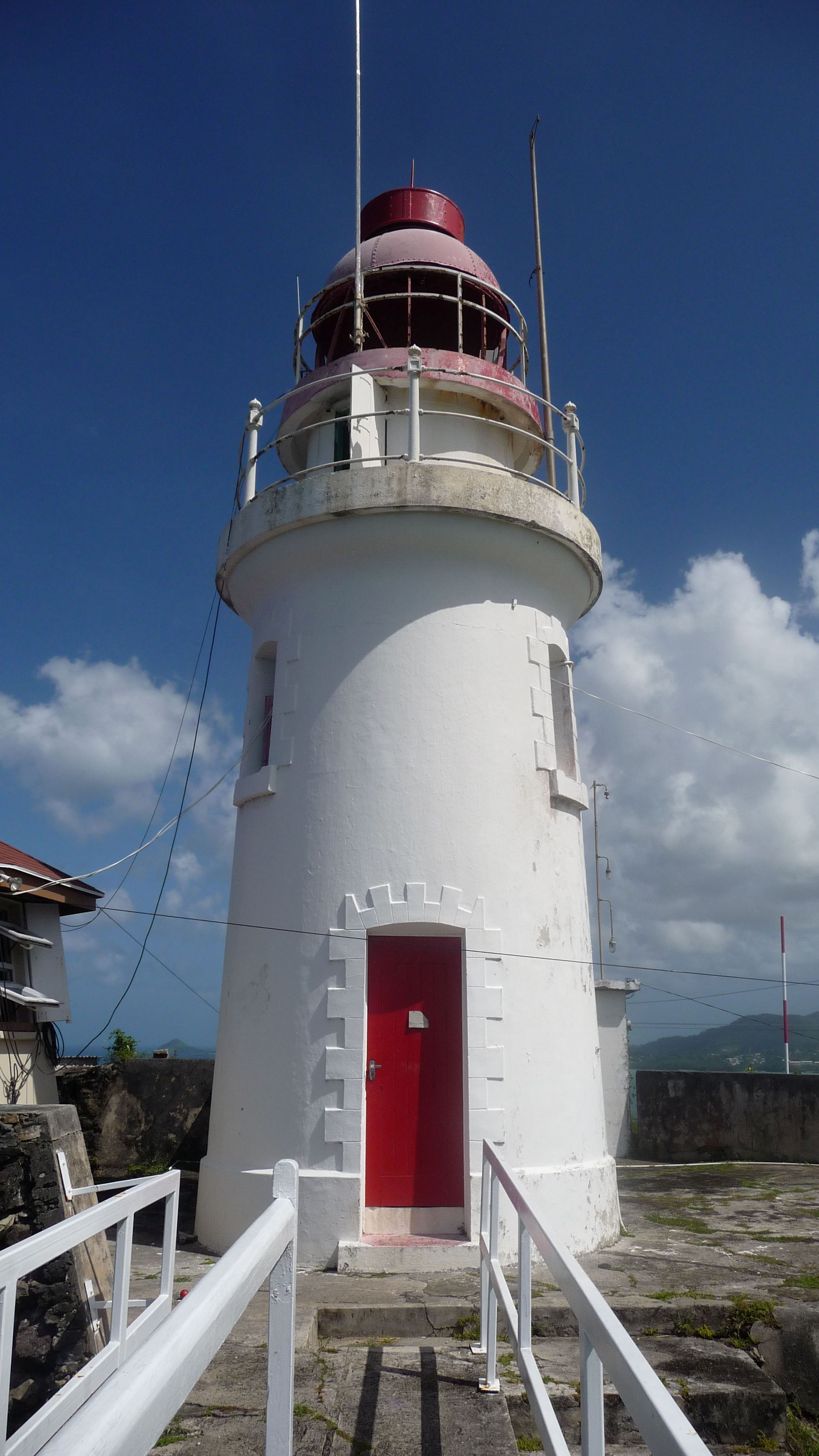
The Vigie Lighthouse is a prominent maritime aid located on Vigie Hill in Castries, Saint Lucia.
History
- The French established a village at the base of Vigie Hill in 1745, and a military headquarters on Vigie Height. Three forts were built: Choc Fort facing Choc Bay, Fort St. Victor at the entrance to Grand Carénage Bay (Castries Harbor), and Fort Montagu overlooking Petit Carénage Bay.
Architecture
The Vigie Lighthouse was constructed in 1914. It stands at a height of approximately 98 meters (322 feet) above sea level, with a focal height of about 120 meters (394 feet). The lighthouse features a distinctive design, reportedly inspired by the French style.
Light Characteristics
The Vigie Lighthouse emits a white light that is visible for up to 22 nautical miles. The light pattern is characterized as a Fl (flash) every 10 seconds, with a specific sequence of flashes and colors.
Current Status
The Vigie Lighthouse remains an active aid to navigation, although its operation may be automated in some capacity.
Location and Accessibility
The Vigie Lighthouse is situated on Beacon Road in Castries, Saint Lucia. The location provides stunning views of the surrounding area, including the nearby George F. L. Charles Airport and the town of Castries.
Heritage Status
The Vigie Lighthouse is reportedly listed as a historical landmark, although specific details regarding its designation are not available.
Notable Historical Events
The Vigie Lighthouse has played a significant role in the maritime history of Saint Lucia, serving as a vital aid to navigation for ships traversing the island's coastline.
Details
| Name | Vigie Lighthouse |
|---|---|
| City | Castries |
| Country | Saint Lucia |
| Coordinates | 14.022347, -61.00122 |
| Current use | active aid to navigation |
Nearby Lighthouses
Other lighthouses close to Vigie Lighthouse
